Red Flag Warning
URGENT – FIRE WEATHER MESSAGE
National Weather Service Boston/Norton MA
349 AM EDT Sat Oct 10 2020
…RED FLAG WARNING IN EFFECT FROM 10 AM THIS MORNING TO 8 PM EDT THIS EVENING FOR CENTRAL AND EASTERN MASSACHUSETTS AS WELL AS NORTHERN AND EASTERN RHODE ISLAND…
The National Weather Service in Boston/Norton has issued a Red Flag Warning, which is in effect from 10 AM this morning to 8 PM EDT this evening. The Fire Weather Watch is no longer in effect.
* TIMING…Late this morning through early evening.
* WINDS…Southwest 15 to 20 mph with gusts between 35 and 45 mph. Strongest of those wind gusts will be towards the Cape and Islands.
* RELATIVE HUMIDITY…Minimum values will range from 40 to 60 percent during the afternoon.
* TEMPERATURES…Generally in 70s during the afternoon.
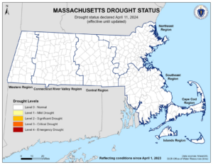
* IMPACTS…Dry weather and gusty winds will result in critical fire weather conditions.
PRECAUTIONARY/PREPAREDNESS ACTIONS…
A Red Flag Warning means that critical fire weather conditions are either occurring now, or will shortly. Any fires that start may spread rapidly and become difficult to extinguish.

Wind Advisory
URGENT – WEATHER MESSAGE
National Weather Service Boston/Norton MA
358 PM EDT Fri Oct 9 2020
…WIND ADVISORY IN EFFECT FROM 7 AM TO 7 PM EDT SATURDAY…
* WHAT…Southwest winds 20 to 30 mph with gusts up to 50 mph expected.
* WHERE…Barnstable MA, Dukes MA and Nantucket MA Counties.
* WHEN…From 7 AM to 7 PM EDT Saturday.
* IMPACTS…Gusty winds could blow around unsecured objects. Tree limbs could be blown down and a few power outages may result.
PRECAUTIONARY/PREPAREDNESS ACTIONS…
Use extra caution when driving, especially if operating a high profile vehicle. Secure outdoor objects.