 HYANNIS – Strong winds and heavy rain will impact Cape Cod and the Islands throughout the day Thursday.
And temperatures will hover around 50 degrees just days after the mercury plunged into the single digits.
The National Weather Service issued a Flash Flood Watch, Coastal Flood Advisory and High Wind Warning for the region.
Splashover in typical prone locations could happen at the time of high tide. Pockets of minor coastal flooding are possible with high tide.
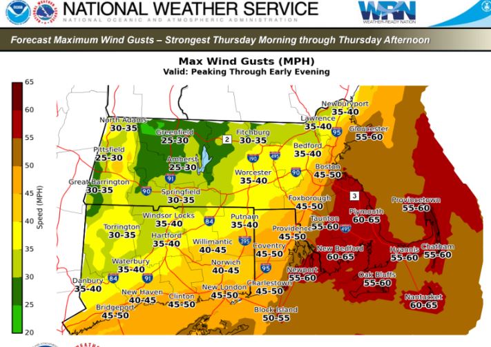
Winds will be out of the south at 25 to 35 mph with gusts as high as 60 into the afternoon.
Several ferry runs between Cape Cod and Nantucket and Martha’s Vineyard have been canceled because of the weather.
That could lead to some blow down trees, power lines and power outages.
The heavy rain combined with frozen ground could result in street flooding. Some small river and stream flooding is also possible.