 HYANNIS – A new interactive map that tracks the movements of tagged sharks in relation to commercial fishing activities was launched by Oceana yesterday as part of Shark Week.
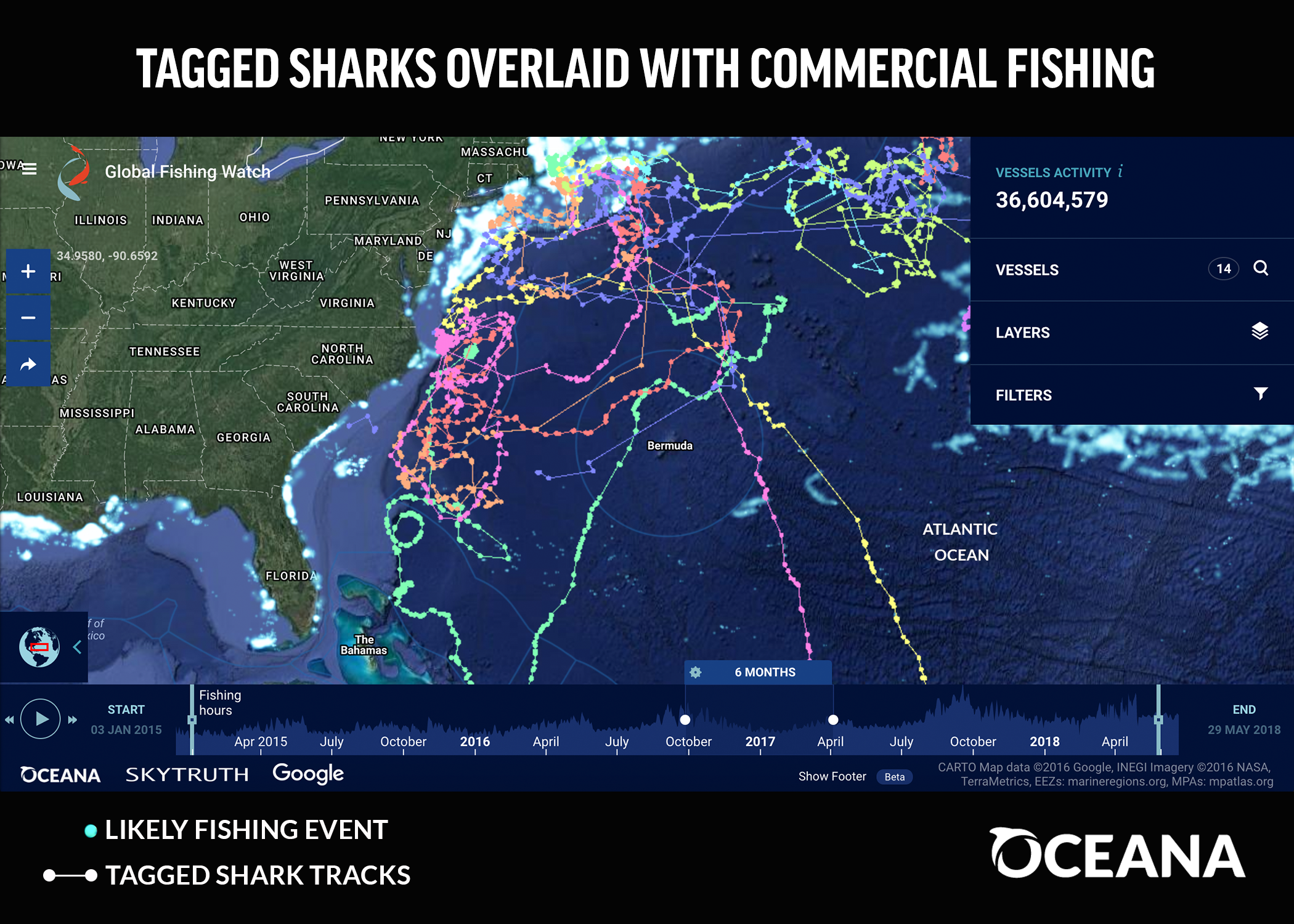
The project, which tracks 45 tagged sharks, is designed to increase the awareness of threats facing the ocean predators, including commercial fishing.
“Sharks are vulnerable to overexploitation and so we are hoping this added transparency will help increase awareness about the threats that sharks face and help protect marine wildlife,” said Lacey Malarky, an analyst with Oceana. “By understanding where these sharks are and the overlap between commercial fishing vessels, researchers and fisheries managers can then study these overlaps and help protect these species better.
The sharks, which have covered more than 150,000 total miles, were tagged at various location around the United States between 2012 and 2018.
They include blue, tiger, shortfin mako, great hammerhead, scalloped hammerhead, porbeagle and dusky sharks.
An 8-foot adult male blue shark named “Buzz” traveled the furthest south of all the tagged sharks — over 3,000 miles in one trip from Cape Cod, past the Caribbean to South America.
“This is one the first times that you can actually visualize how far these sharks are traveling,” Malarky said. “It’s very impressive and it’s all throughout the Atlantic Ocean.”
Malarky said researchers hope to get more data to add to the map from other species.
“This will be a real hub for enthusiasts,” she said.
The interactive map can be found here.