Courtesy Town of Nantucket
NANTUCKET – The design phase of a project that would provide alternate access to residents along a coastal road on Nantucket is moving forward.
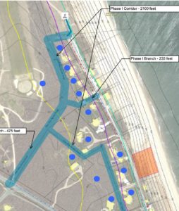
Project Manager William Casey gave an update on the design phase of the Baxter Road project at a recent meeting of the town’s select board. He highlighted the purpose of the project and why the work may need to be completed in the future.
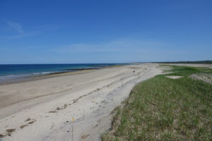
“To provide alternative access and relocation of utilities for the Baxter Road residents should erosion continue along the bluff, putting existing Baxter Road in jeopardy,” Casey said.
Casey explained the construction work involved in the project would only start if erosion made Baxter Road unsafe.
If erosion progressed to that point and the work was completed, people in the area would have access to their residences off of Sankaty Road instead.
Casey added residents should expect a series of construction projects to clear access ways and to reroute water and sewer utilities in that scenario.
The project manager noted that individual grinders would be the best type of sewage system to use.
Coastal Resilience Coordinator Vincent Murphy presented a FEMA map of coastal erosion hazard areas.
The map featured projections over the next 70 years and Murphy said the project is being designed with the anticipated amount of erosion for the year 2050 in mind.
“So this is the next phase of how we plan to give as many people access for as long as possible so we can continue to provide services to the people in this area,” Murphy said.
The project team said that they have been communicating with homeowners in the area to figure out the best solutions should work need to begin.
The team expects to remain in the design phase through the summer and fall and they will continue to coordinate with residents as they settle on a finalized layout.
Another project update is expected in the fall.
By Brian Engles, CapeCod.com NewsCenter