HYANNIS – Utility crews continued to make progress late Sunday night and early Monday morning in restoring power to thousands of Cape Codders left in the dark from the weekend nor’easter.
Just under 10,000 Eversource customers were still without power before dawn Monday as the region slowly recovered from a storm that delivered hurricane-force winds and significant coastal erosion.
Officials said they hope to have all power service restored by Tuesday night. Thousands of workers are on the job, according to Eversource.
“Our repair and restoration effort after such a violent storm is a demanding task for crews and support personnel, especially on Cape Cod, the South Shore, and the South Coast, where the damage was so bad entire sections of the electric system are having to be rebuilt,” said Eversource Vice President of Electric Operations Doug Foley.
“Thanks to the tireless work of the thousands of employees and contractors we’ve dedicated to this restoration, we’re able to move up our original estimated restoration time for most customers by about 24 hours,” he said.
The Barnstable County Regional Emergency Planning Committee has closed the final shelter that was used in response to the storm.
The Cape Cod Regional Technical High School housed 20 people from Sunday night into Monday morning. It was closed at noon today.
A warming station has been opened at the Harwich Community Center. A reception center is also open at the American Red Cross headquarters on South St. in Hyannis.
The county operated shelters in Falmouth and Hyannis in the immediate aftermath of the storm. Both were closed Sunday night.
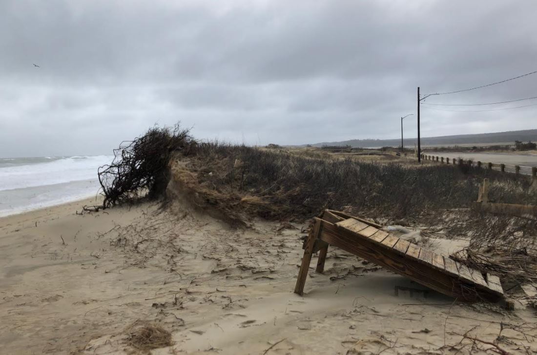
Town Neck Beach in Sandwich
The Steamship Authority has returned to service after travel was disrupted by Friday’s nor’easter.
The ferry provider says trips to and from Martha’s Vineyard and Nantucket are running on a boat-by-boat basis.
Hyline is also operating on a boat-by-boat basis.
Meanwhile, forecasters are watching a system that is expected to impact New England.
The National Weather Service is predicts another coastal storm to bring snow and gusty winds to New England starting Wednesday morning and continuing into Thursday. Snow is forecast to begin mainly after the Wednesday morning commute and continue through Wednesday night before tapering off during the morning commute on Thursday.
The greatest impact appears to be the late day Wednesday commute and possibly lingering into the Thursday morning commute.
Snow may fall at a rate of as much as 1-2 inches per hour at the peak of the storm late Wednesday into Wednesday night. A potential change to rain is possible for portions of eastern Massachusetts, but the location of the rain/snow line remains highly uncertain.
The changeover from snow to rain would most likely take place late Wednesday afternoon or evening. In the vicinity of the rain/snow line, snow is likely to be wet and heavy.
Snowfall totals could reach 8-12 inches over much of Massachusetts, with 6-8 inches falling in parts of far western Massachusetts and the Connecticut River valley, 4-6 inches in the vicinity of the rain/snow line, and up to 2-3 inches in southeastern Massachusetts.
Thirty-to-40 MPH wind gusts, with up to 50 MPH gusts are expected over the Cape and Islands, are forecast, with the strongest winds occurring Wednesday night into Thursday morning.
A storm surge of around 2.5 to 3 feet and 15-20 foot waves just offshore are forecast. At worst, this could result in minor coastal flooding and moderate beach erosion for the early Thursday morning high tide. This will likely be the only high tide with any coastal impacts.
A slight shift in storm track will determine whether the heaviest snow would occur across Connecticut into western-central Massachusetts, or farther east into Rhode Island and eastern Massachusetts, impacting the Boston to Providence corridor.
Storm surge and offshore wave action could result in minor coastal flooding and moderate beach erosion during the early Thursday morning high tide. Heavy snow and gusty winds will result in hazardous travel conditions due to slippery road conditions and lowered visibility from blowing and drifting snow. Both the Wednesday evening and Thursday morning commutes may be impacted by this event.\
Heavy wet snow in the vicinity of the rain/snow line may result in downed tree branches/limbs, increasing the risk for isolated power outages.