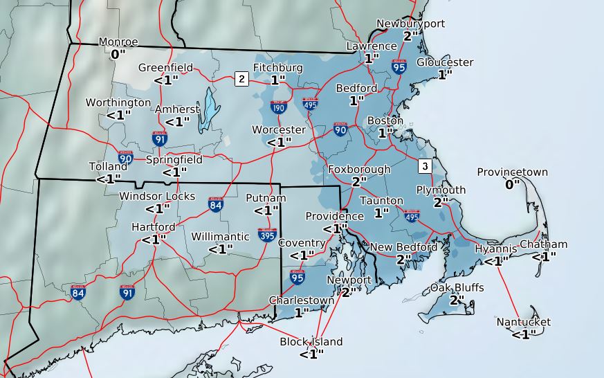
 HYANNIS – The fourth nor’easter in the last few weeks looks like a minimal impact event, with much of the region reporting no more than an inch or two of slushy, wet snow.
Snow and rain are expected to continue this morning, but forecasters are only calling for an additional coating to an inch of accumulation.
A high wind warning remains in effect, meaning ferry travel to and from the islands will be on a boat-by-boat basis Thursday.
Several early-morning runs by the Steamship Authority and and Hy-Line were cancelled.
No schools reported any delays or closures and no power outages had been reported.
State Police did respond to a weather-related rollover crash on Route 6 in Barnstable just before 5:30 a.m.