


CCB MEDIA PHOTO
Architect Mary-Ann Agresti and Brian Dale, facilities manager with the Cape Cod Regional Transit Authority, talk about Sea Captain’s Row Map and Guide.
HYANNIS – Mary-Ann Agresti, an architect with offices in Hyannis, had never walked around the historic streets where her business is located, until a resident took her on a tour.
But once she saw the neighborhood, she was charmed by the old captain’s houses shaded by massive trees just steps from Hyannis Harbor, on Pleasant Street.
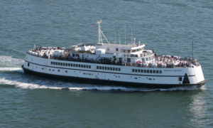
Agresti wanted others to know about this gem just off Main Street, so she has put together the Hyannis Sea Captain’s Row Map and Guide, a self-guided walking tour of the area that highlights points of interest between the train station and the ferry.
Agresti had help on the project from Brian Dale, the facilities manager for the Cape Cod Regional Transit Authority. Dale used to be tree warden in the town of Falmouth. From Dale, Agresti learned the trees along the street were likely planted by those sea captains when they settled the area more than 150 years ago.
“It’s my suspicion that many of these trees that are in hedgerows between some of these properties as well as some of the street trees are actually remnants of trees that were brought over back in the 1800s by seafaring captains from all parts of the world,” Dale said.
Trees on the street include the sycamore maple and the copper beech, which are native to Europe, and the butternut, which is native to North America. “That’s actually quite unusual that there are still healthy sections of butternut, because there was a blight that has affected the butternut. There are really not all that many remaining butternuts in the eastern United States, Dale said.
“I absolutely thought that these were indicative of plantings of sea captains back in this era,” he said.
Through the project, Agresti learned that Hyannis had 150 sea captains living in town in the mid-1800s and there are many remaining sea captain’s homes in the area the map covers.
And she learned that President Ulysses S. Grant spoke at the corner of Pleasant Street and Main Street to inaugurate the railroad when it was extended from Hyannis to Provincetown. “He came from the Vineyard on the River Queen, which alone is an amazing story as it was the office during the Civil War for Grant and Lincoln, and then traveled on the trail from Hyannis to Provincetown, stopping at every stop to lots of people cheering him on. So there are a lot of interesting tidbits that we want people to know about,” Agresti said.
Agresti calls the philosophy behind the project “Spaces Between.”
“It’s sort of a forgotten spot, the east part of Main Street in Hyannis. It occurred to us there were some really amazing things that were there. It occurred to us that we should do a project where we could highlight them to others,” Agresti said.
The project had its inception at a meeting both Agresti and Dale attended having to do with the redevelopment of the east end of Main Street.
A neighbor at the meeting, Dominic Allesandra, told them the history of the area and the surrounding streets.
“When I was introduced to Dom and he gave me a walk of his own perception of the neighborhood and made me aware that it was a nationally registered neighborhood historically since 1987, my own architect’s eyes were opened,” Agresti said.
That eye-opening experience fits in with a theory about noticing places, Agresti said.
“I realized there are a lot places that are between two points on the Cape. We have the transportation center which is a great point and then we have the harbor or the ferry which is a great point. But the space between where thousands of people walk throughout the summer in an effort to catch their ferry or catch their bus or catch their train, was sort of a lost place. It was this ligament that connected two places that people hadn’t paid a lot attention to,” she said.
Having put together the map on the Hyannis neighborhood, Agresti is now looking for more “places between” where she can create maps that offer a kind of history lesson.
“On the Cape we can really highlight these moments and use it as an economic engine for people to really become more aware of what’s happened to the Cape over the past 100 years in a different way,” she said.
Agresti said the map is sponsored by Care for the Cape & Islands, which gives grants to projects that unite tourism and caring for the Cape in a deeper way. The project has also received support from the Cape Cod Regional Transit Authority and the Hy-Line Cruises.
The walking trail project is a collaboration with the Cape Cod Maritime Museum.
Agresti even took the project’s history theme to a colorful level earlier this summer. As an introduction to the project, Agresti, Allesandra and others met the first Cape Flyer summer train from Boston in period attire and handed out copies of the map to Sea Captain’s Row.
Listen below to hear Mary-Ann Agresti and Brian Dale talk about the Sea Captain’s Row self-guided walking tour.


Speak Your Mind