



 BARNSTABLE – The Cape Cod Commission is launching a regional traffic safety study targeting five intersections across Cape Cod that have been identified as areas of concern because of crashes, congestion and other safety issues.
The initiative, known as the Various Intersection Study, will examine locations in Sandwich, Falmouth, Barnstable, Harwich and the Harwich-Chatham town line, with the goal of identifying potential improvements for motorists, bicyclists and pedestrians.
The study is being conducted as part of the Commission’s 2027 Unified Planning Work Program and is expected to take approximately one year to complete.
Cape Cod Commission Senior Transportation Planner David Nolan recently outlined the project during a Joint Transportation Committee meeting, explaining that the initiative will take a regional approach rather than focusing on a single roadway.
“This various intersection study will replicate a corridor planning study,” Nolan said. “But rather than focusing on a single corridor in one town, we will examine five intersections across the region.”
The five intersections selected for the study are:
Sandwich – Route 6A at Route 130 and Tupper Road: Identified as the highest crash location in the Commission’s Route 6A Visioning Study, the intersection experiences significant congestion during peak travel periods and features numerous turning movements that can create challenging traffic conditions.
Falmouth – Sandwich Road at Brick Kiln Road: Ranked 36th in Barnstable County for total crashes, the intersection averages approximately 10 crashes annually. It was also identified as a location of concern in the regional Vision Zero High Injury Network.
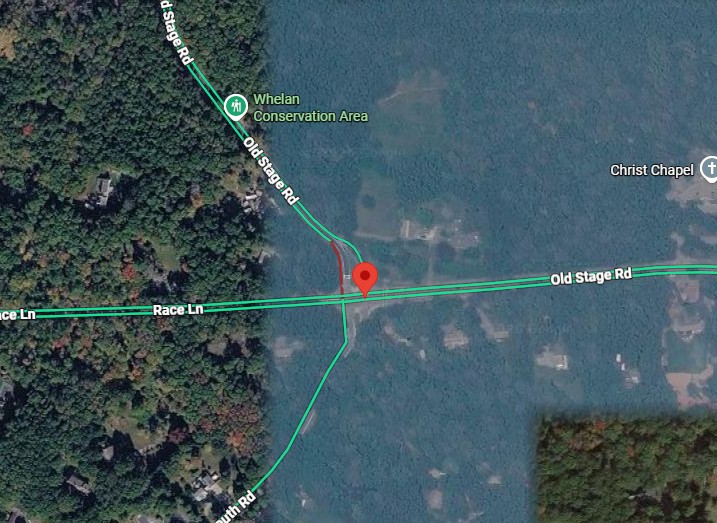
Barnstable – Old Stage Road at Race Lane and Old Falmouth Road: This wide, multi-leg intersection handles significant traffic and is also used by bicyclists and pedestrians. According to the Commission, angle crashes account for the vast majority of reported collisions at the location.
Harwich – Depot Street at Old Chatham Road and Factory Road: Identified as a higher-risk location through the Commission’s Vision Zero analysis, the intersection has experienced two fatal crashes and nine injury crashes in recent years.
Harwich/Chatham – Route 137 at Old Queen Anne Road and Queen Anne Road: The busy intersection was the subject of a traffic signal warrant analysis in 2025. The new study will revisit whether traffic signals or other safety improvements would be appropriate. Most crashes at the location occur during daytime periods of congestion.
Commission officials said the intersections were selected after reviewing several sources of traffic safety information, including the regional Vision Zero Action Plan and the Top 50 Crash Locations report.
Priority was given to intersections that have not recently undergone major construction, road safety audits or other significant transportation planning efforts.
The study will include detailed crash analyses, evaluations of existing traffic patterns and assessments of accommodations for pedestrians, bicyclists and public transportation.
Planners will also examine whether additional infrastructure or roadway changes could improve safety and traffic flow.
Public participation will be a major component of the project.
The Commission plans to hold a public meeting, conduct an online survey and develop an interactive online data viewer that will allow residents to review information about the intersections.
Similar public engagement tools have been used during the Commission’s Route 6A Visioning Project and Complete Streets planning initiatives.
Over the coming months, transportation planners will continue reviewing crash data, developing the online viewer and preparing for public outreach.
The first opportunities for public participation are expected this winter.
The study is intended to identify potential safety improvements and recommendations for future transportation projects. The Commission has not announced any construction schedules or funding commitments for improvements at the five intersections.
Additional information about the Cape Cod Commission’s regional transportation planning efforts is available through the Commission’s website.
Copyright Pitta Media Group 2026. Any unauthorized use not permitted. All rights reserved.