




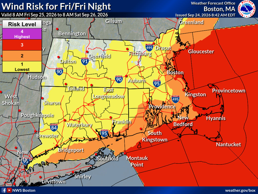
 (HYANNIS) – An early-season nor’easter was expected to impact Cape Cod, the Islands, and other parts of coastal Massachusetts throughout the weekend with high winds, coastal flooding, and heavy rain.
Forecasters said the storm formed off the North Carolina coast and would meander northeast through Sunday, with the peak impacts likely happening on Saturday into Saturday night.
The National Weather Service was predicting showers to overspread the area on Friday with winds out of the north at 21 to 25 mph, and gusts as high as 46 mph. The rain will continue into Friday night with possible gusts out of the north at 45 mph to 60 mph.
The storm was forecast to continue churning off the coast on Saturday with showers, thunderstorms, and winds out of the northeast at 28 to 30 mph and gusts up to 55 mph.
The National Weather Service issued a Coastal Flood Watch, High Wind Warning, and High Surf Advisory for the Cape & Islands through late in the weekend.
Forecasters said there could be large breaking waves of six to 17 feet just off shore and in the surf zone, with possible flooding above ground level in low-lying areas near the shoreline.
Due to the intensity and duration of the storm over several days, beach erosion was expected, especially along the northeast facing shorelines.
The strong winds could blow down tree limbs and cause scattered power outages across the area. Utility companies were making plans to have crews positioned to deal with any damage and power interruptions. Eversource sent a message to electric customers on Thursday afternoon urging them to follow the forecast and prepare for outages.
Ferry service between Cape Cod and the Islands was already being impacted on Thursday afternoon. Both the Hy-Line and Steamship Authority urged passengers to monitor their social media channels and websites for updates.
The exact timing of the storm will be important for peak surge around the times of high tides. Multiple tide cycles will be impacted, which combined with strong onshore flow may result in tides not lowering as well.
Conditions could improve slightly on Sunday with showers and winds lessening to 16 to 21 mph and gusts to 40 mph.