




URGENT – IMMEDIATE BROADCAST REQUESTED
Flood Watch
National Weather Service Boston/Norton MA
1230 AM EDT Mon Jul 6 2026
…FLOOD WATCH IN EFFECT THROUGH TUESDAY AFTERNOON…
* WHAT…Flash flooding caused by excessive rainfall continues to be possible.
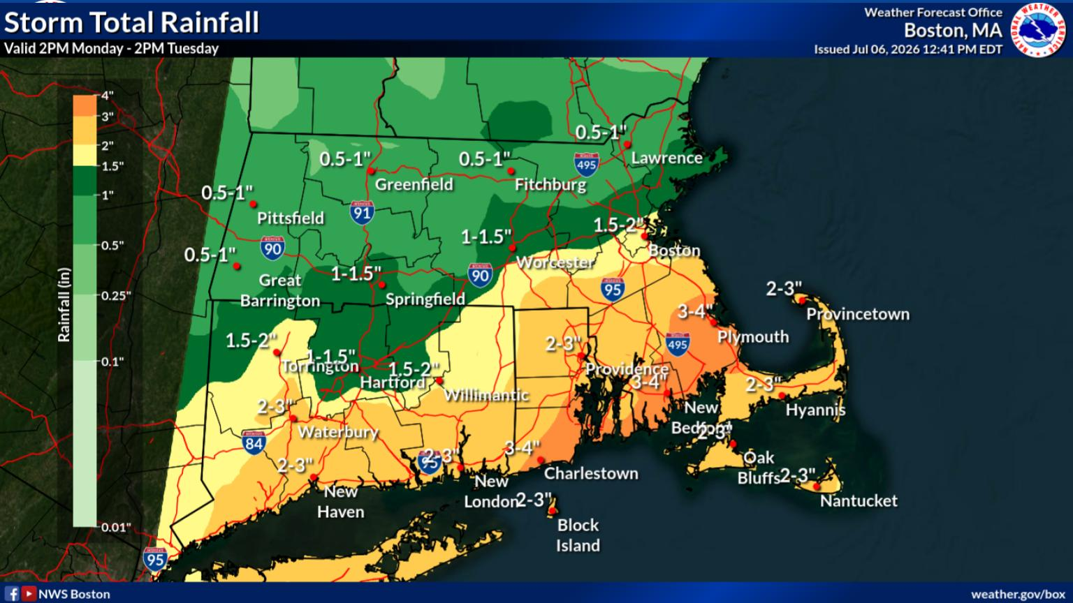
* WHERE…A portion of southeastern Massachusetts, including the following areas, Barnstable MA, Eastern Plymouth MA, Northern Bristol MA, Southern Plymouth MA and Western Plymouth MA.
* WHEN…Through Tuesday afternoon.
* IMPACTS…Excessive runoff may result in flooding of rivers, creeks, streams, and other low-lying and flood-prone locations.
* ADDITIONAL DETAILS…
– Periods of heavy rain are expected at times today into Tuesday afternoon. Widespread rainfall amounts of 1-3 inches are expected into Tuesday. However, narrow bands of torrential rainfall may result in localized amounts of 4-6 inches of rain inside 6 hours. It remains low confidence when and where these potential narrow bands of heavy rainfall setup. However, if they occur they will bring the potential for urban and/or small stream flash flooding. http://www.weather.gov/safety/flood
PRECAUTIONARY/PREPAREDNESS ACTIONS…
You should monitor later forecasts and be prepared to take action should Flash Flood Warnings be issued.