




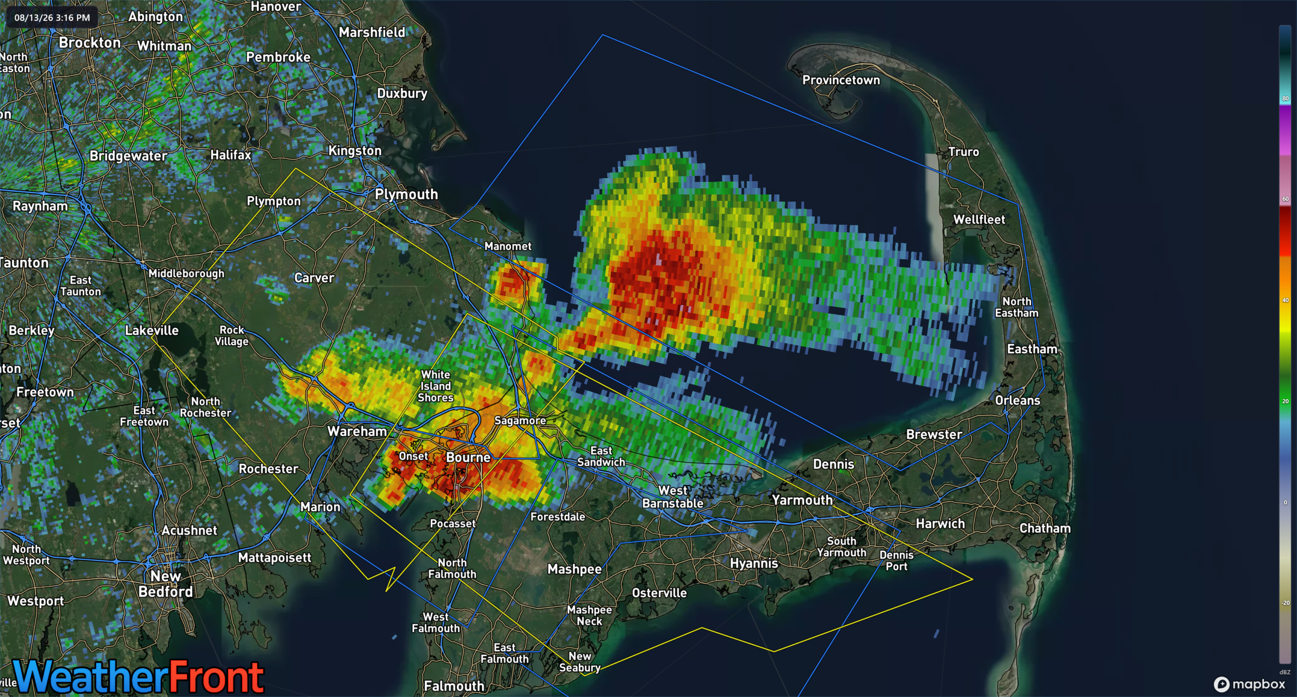
Severe thunderstorm warning cancelled, strong storms still possible from Yarmouth to Eastham.
The National Weather Service in Boston/Norton has issued a
* Severe Thunderstorm Warning for…
Southern Barnstable County in southeastern Massachusetts…
Southeastern Plymouth County in southeastern Massachusetts…
* Until 415 PM EDT.
* At 315 PM EDT, a severe thunderstorm was located over Bourne, or 8 miles south of Plymouth, moving southeast at 20 mph.
HAZARD…60 mph wind gusts and nickel size hail.
SOURCE…Radar indicated.
IMPACT…Expect damage to trees and power lines.
* Locations impacted include…
Plymouth, Barnstable, Falmouth, Marion, Yarmouth, Wareham, Sandwich, Bourne, Dennis, Mashpee, Harwich, and Hyannis.
PRECAUTIONARY/PREPAREDNESS ACTIONS…
For your protection move to an interior room on the lowest floor of a
building.
BULLETIN – IMMEDIATE BROADCAST REQUESTED
Special Marine Warning
National Weather Service Boston/Norton MA
325 PM EDT Thu Aug 13 2026
The National Weather Service in Boston/Norton has issued a
* Special Marine Warning for…
Cape Cod Bay…
Nantucket Sound…
* Until 430 PM EDT.
* At 324 PM EDT, a severe thunderstorm capable of producing waterspouts was located near Cape Cod Bay, moving southeast at 10 knots.
HAZARD…Waterspouts and wind gusts to 40 knots.
SOURCE…Radar.
IMPACT…Waterspouts can easily overturn boats and create locally hazardous seas. Small craft could be damaged in briefly higher winds and suddenly higher waves.
* Locations impacted include…
Cape Cod Bay, The East End Of Cape Cod Canal, and Barnstable Harbor.
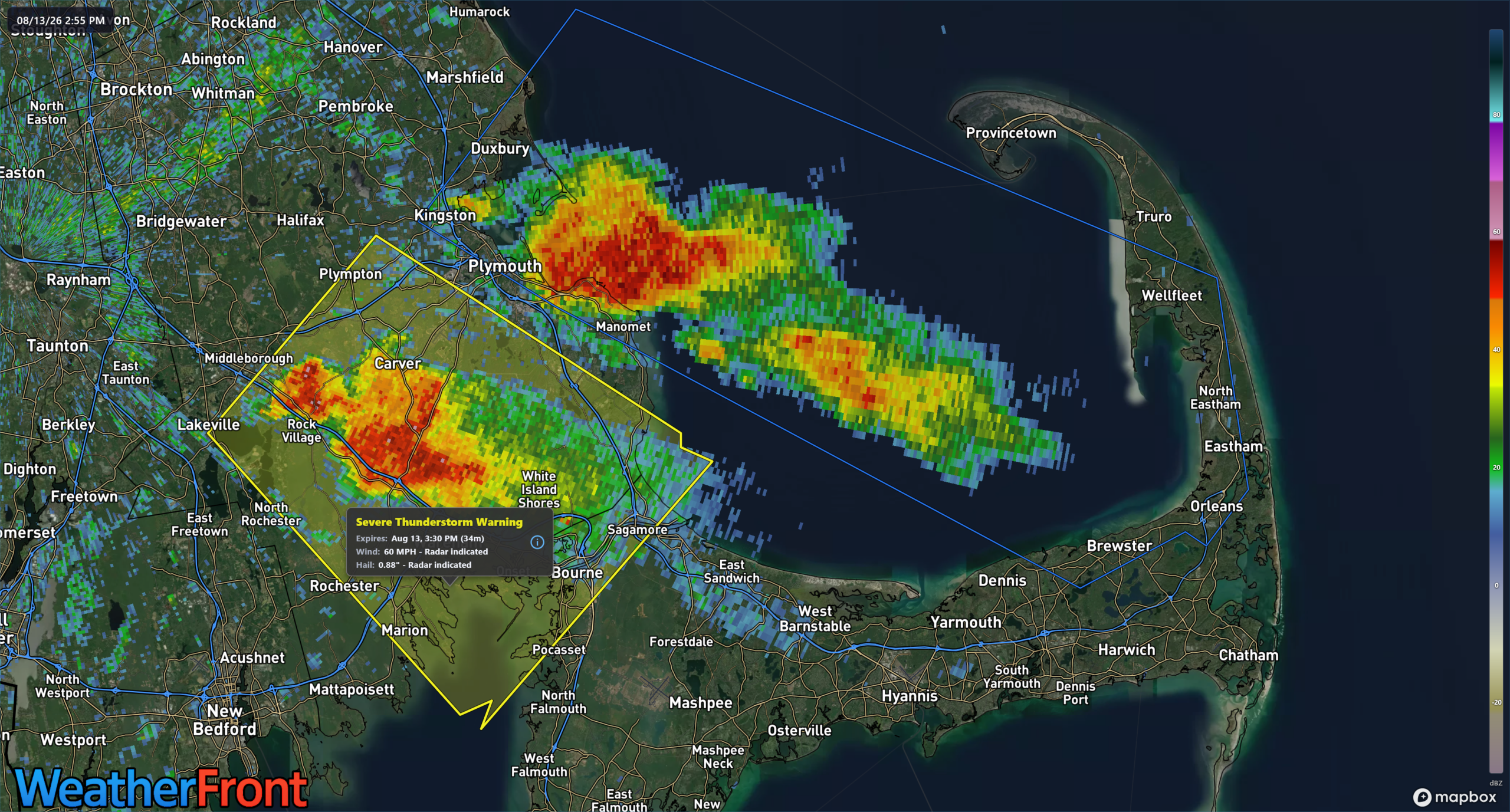
…A SEVERE THUNDERSTORM WARNING REMAINS IN EFFECT UNTIL 330 PM EDT FOR WESTERN BARNSTABLE AND SOUTHEASTERN PLYMOUTH COUNTIES…
At 255 PM EDT, a severe thunderstorm was located over Carver, or 7 miles west of Plymouth, moving southeast at 15 mph.
HAZARD…60 mph wind gusts and nickel size hail.
SOURCE…Radar indicated.
IMPACT…Expect damage to trees and power lines.
Locations impacted include… Plymouth, Marion, Middleborough, Wareham, Bourne, Kingston, Carver, Lakeville, Rochester, and Plympton.
PRECAUTIONARY/PREPAREDNESS ACTIONS…
For your protection move to an interior room on the lowest floor of a building.
The National Weather Service in Boston/Norton has issued a
* Severe Thunderstorm Warning for…
Western Barnstable County in southeastern Massachusetts…
Southern Plymouth County in southeastern Massachusetts…
Central Bristol County in southeastern Massachusetts…
* Until 330 PM EDT.
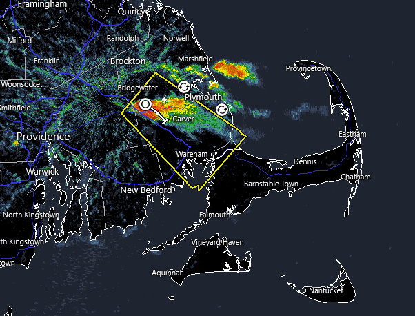
* At 225 PM EDT, a severe thunderstorm was located over Middleborough, or near Bridgewater, moving southeast at 15 mph.
HAZARD…60 mph wind gusts and nickel size hail.
SOURCE…Radar indicated.
IMPACT…Expect damage to trees and power lines.
* Locations impacted include…
Plymouth, Taunton, Bridgewater, Marion, Middleborough, Wareham, Bourne, East Bridgewater, Raynham, Kingston, Carver, Lakeville, Hanson, Halifax, Rochester, and Plympton.
PRECAUTIONARY/PREPAREDNESS ACTIONS…
For your protection move to an interior room on the lowest floor of a building.