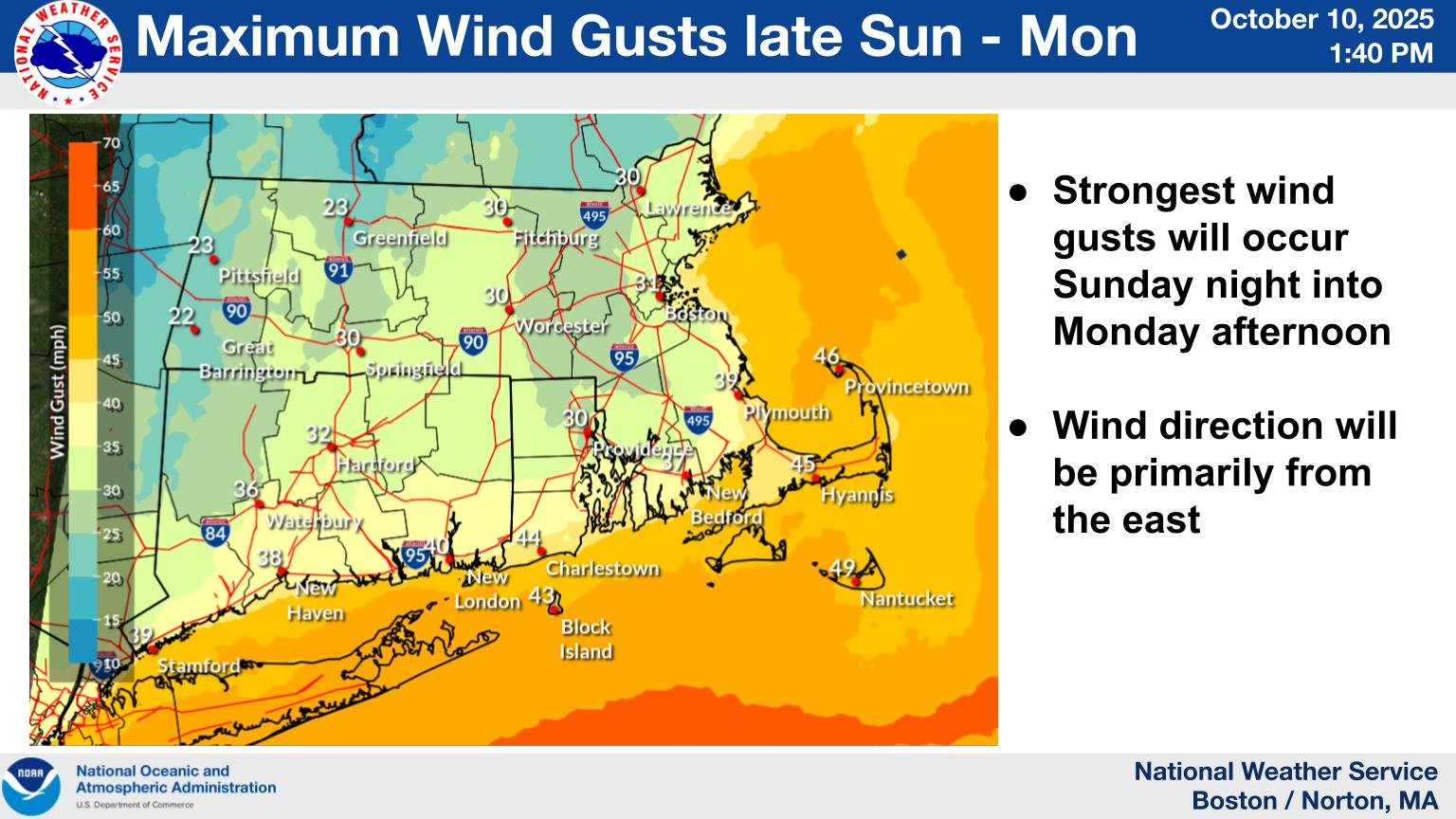
Wind Advisory
URGENT – WEATHER MESSAGE
National Weather Service Boston/Norton MA
209 PM EDT Fri Oct 10 2025
…WIND ADVISORY IN EFFECT FROM 8 PM SUNDAY TO 8 PM EDT MONDAY…
* WHAT…East winds 15 to 25 mph with gusts up to 50 mph possible.
* WHERE…Barnstable MA County.
* WHEN…From 8 PM Sunday to 8 PM EDT Monday.
* IMPACTS…Gusty winds will blow around unsecured objects. Tree limbs could be blown down and some power outages may result.
PRECAUTIONARY/PREPAREDNESS ACTIONS…
Winds this strong can make driving difficult, especially for high profile vehicles. Use extra caution.
Coastal Hazard Message
National Weather Service Boston/Norton MA
1020 AM EDT Sat Oct 11 2025
…COASTAL FLOOD ADVISORY IN EFFECT FROM 2 PM TO 6 PM EDT SUNDAY…
* WHAT…Up to one half foot of inundation above ground level expected in low-lying areas near shorelines and tidal waterways (3.5 to 12.6 feet Mean Lower Low Water).
* WHERE…Eastern Essex MA, Suffolk MA, Eastern Norfolk MA, Eastern Plymouth MA, Barnstable MA, Dukes MA and Nantucket MA Counties.
* WHEN…From 2 PM to 6 PM EDT Sunday.
* IMPACTS…Roads remain passable. Shallow pockets of flooding less than one foot deep affect more vulnerable coastal roads along the North Shore from Salem and Gloucester to Newburyport. Rough surf will likely cause some splashover onto coastal roads around the time of high tide. Roads remain passable. Low lying areas and roads near Nantucket Harbor, including Easy Street, may experience pockets of shallow flooding less than one foot deep.
PRECAUTIONARY/PREPAREDNESS ACTIONS…
If travel is required, allow extra time as some roads may be closed. Do not drive around barricades or through water of unknown depth. Take the necessary actions to protect flood-prone property.