Wind Advisory
URGENT – WEATHER MESSAGE
National Weather Service Boston/Norton MA
335 AM EST Sat Mar 9 2024
…WIND ADVISORY IN EFFECT FROM MIDNIGHT EST TONIGHT TO 10 AM EDT SUNDAY…
* WHAT…Southeast winds 25 to 35 mph with gusts up to 50 mph expected.
* WHERE…Barnstable MA and Nantucket MA Counties.
* WHEN…From midnight EST tonight to 10 AM EDT Sunday.
* IMPACTS…Gusty winds will blow around unsecured objects. Tree limbs could be blown down and a few power outages may result.
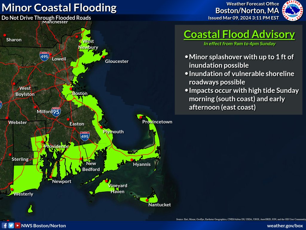
Coastal Flood Advisory
Coastal Hazard Message
National Weather Service Boston/Norton MA
303 PM EST Sat Mar 9 2024
…COASTAL FLOOD ADVISORY IN EFFECT FROM 6 AM TO 2 PM EST SUNDAY…
* WHAT…One to two feet of inundation above ground level expected in low-lying areas near shorelines and tidal waterways (2.8 to 13.0 feet Mean Lower Low Water).
* WHERE…Portions of southeastern Massachusetts and northern and southern Rhode Island.
* WHEN…From 6 AM to 2 PM EST Sunday.
* IMPACTS…Minor coastal flooding occurs along the most vulnerable shoreline locales in Newport, Portsmouth and Middletown. This includes flooding at parking lots near beaches in Newport, and a portion of Hazard Road. Minor coastal flooding also occurs on several streets in the Common Fence Point area. Roads remain passable. Shallow pockets of flooding less than one foot deep affect low lying areas in Provincetown, mainly near the airport and Race Point Road. In Truro, flooding up to one foot deep affects low lying areas near Pamet Harbor and along the Pamet River.
PRECAUTIONARY/PREPAREDNESS ACTIONS…
If travel is required, allow extra time as some roads may be closed. Do not drive around barricades or through water of unknown depth. Take the necessary actions to protect flood-prone property.