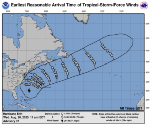
Wind Advisory
URGENT – WEATHER MESSAGE
National Weather Service Boston/Norton MA
146 PM EDT Wed Aug 20 2025
…WIND ADVISORY IN EFFECT FROM 5 PM THURSDAY TO 2 PM EDT FRIDAY…
* WHAT…Northeast winds 15 to 30 mph with gusts up to 50 mph expected.
* WHERE…Barnstable MA, Dukes MA, and Nantucket MA Counties.
* WHEN…From 5 PM Thursday to 2 PM EDT Friday.
* IMPACTS…Gusty winds will blow around unsecured objects. Tree limbs could be blown down and some power outages may result.
* ADDITIONAL DETAILS…Highest winds expected near Nantucket and the outer portions of Cape Cod.
PRECAUTIONARY/PREPAREDNESS ACTIONS…
Winds this strong can make driving difficult, especially for high profile vehicles. Use extra caution.
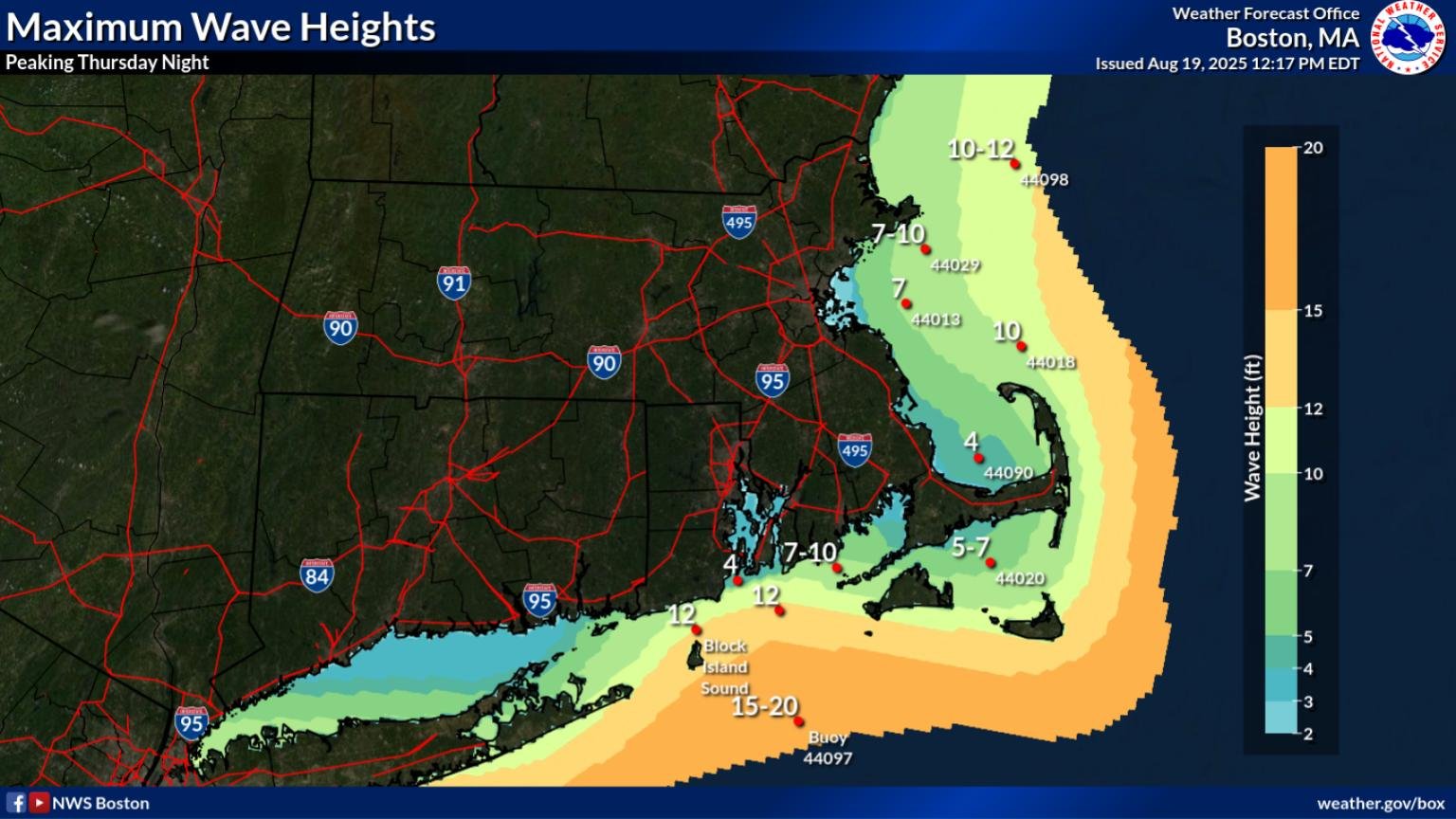
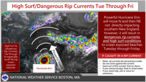
High Surf Advisory
Coastal Hazard Message
National Weather Service Boston/Norton MA
314 PM EDT Wed Aug 20 2025
…HIGH SURF ADVISORY REMAINS IN EFFECT UNTIL 8 PM EDT SATURDAY…
* WHAT…Large breaking waves of 4 to 18 feet in the surf zone.
* WHERE…Southern Plymouth MA and Barnstable MA Counties.
* WHEN…Until 8 PM EDT Saturday.
* IMPACTS…Dangerous swimming and surfing conditions and localized beach erosion.
PRECAUTIONARY/PREPAREDNESS ACTIONS…
Inexperienced swimmers should remain out of the water due to dangerous surf conditions.