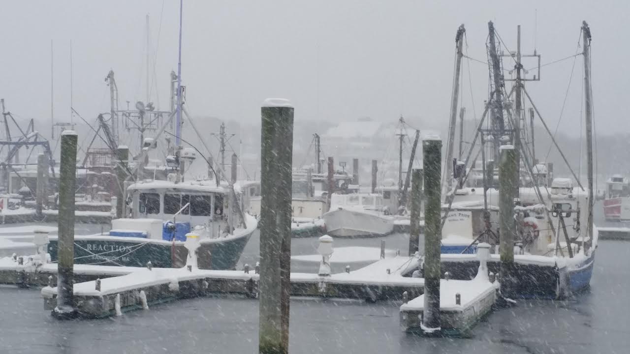
CCB MEDIA PHOTO: Saquatucket Harbor in Harwich Port as heavy snow falls on Saturday
HYANNIS – The second round of winter weather in two days is delivering a heavy accumulation of snow to Cape Cod and the Islands.
The National Weather Service has issued a blizzard warning for Cape Cod, Nantucket, Martha’s Vineyard and parts of eastern Plymouth County until 3 a.m. Sunday
Forecasters said a low pressure system off the coast of South Carolina intensified and will move southeast of New England throughout the evening, delivering a swath of heavy, wind-driven snow.
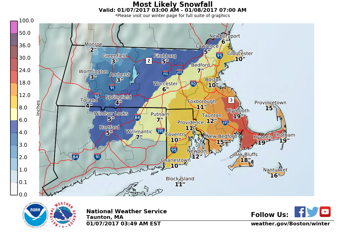
Twelve to 18 inches could fall across the warning area before it all ends early Sunday morning. Once the storm moves away from the region, lingering snow squalls will accompany an arctic front and bitterly cold temperatures into Monday morning, with a warming trend finally arriving by Tuesday.

CCB MEDIA PHOTO: Snow falling in Barnstable Village Friday. More snow was expected Saturday as a blizzard warning was issued for Cape Cod
At the height of the storm, winds will be out of the north-northeast, increasing to 20-30 mph along the coast, with gusts up to 45 mph on Cape Cod and coastal Plymouth County.
Snow accumulations will be less further away from the coast.
Saturday’s storm follows a smaller brush with winter weather on Friday, which delivered up to 5 inches of snow in some parts of Cape Cod.
Several area towns had issued parking bans and storm emergencies in advance of the second storm.
The Barnstable County Regional Emergency Planning Committee (BCREPC) decided against activating the Regional Shelter System Saturday afternoon.
The committee held a planning conference call in the morning to review the latest forecasts and determined that the system wasn’t need since it will be a fast-moving storm and the temperatures warm up later in the week.
“If conditions change than we will have to re-evaluate that decision, but at present, we will not be opening the Emergency Shelter System,” said Public Information Officer Kevin Morley.
The committee is advising the public to be prepared for winter weather conditions and refrain from driving during the storm to enable highway crews to treat and clear the roads.
“During the storm, the visibility is predicted to get close to zero with the blowing and drifting and the dry conditions, so stay off the roads” said Morley.
“By now I hope everyone has run to the grocery store and picked up their supplies, so everybody just hunker down and look at the sunshine tomorrow,” said Morley.
 The Cape Cod Regional Transit Authority canceled all Cape Cod RTA fixed route and DART service for Saturday. DART service will also be canceled for Sunday morning.
Plymouth and Brockton Bus Lines canceled all service between Cape Cod and Boston after the 1:45 p.m. run from Logan Airport to Hyannis. Peter Pan Bus Lines canceled all service between Woods Hole and Providence and Woods Hole and Boston.
Rectrix Aviation canceled service from Hyannis to Nantucket both for both Saturday and Sunday. Cape Air canceled all their flights by mid-morning.
The Barnstable Municipal Airport in Hyannis closed at 12 p.m. Assistant Airport Manager Katie Servis said crews would continue to plow the runways throughout the storm, but it was unknown when they would re-open.
“It’s just going to be a challenge for our staff to keep up with that blowing snow. Typically in any type of storm, what we try to do is we concentrate on one runway and one taxiway,” said Servis.
The Massachusetts Emergency Management Agency in Framingham increased its activation alert to Level II, to support local and state storm response needs.
MEMA spokesman Chris Besse said people should stay off the roadways during the storm, but if they have to travel, make sure to be prepared.
“Just want people to give themselves extra time, make sure that they have got simple emergency supplies in their car, extra blankets and a flashlight just in case there’s a problem or people get stranded for a little while, that they have what they need,” said Besse.
Besse notes that this storm will be milder compared to storms over the past couple of years, but they are still actively watching it.
At one point, MEMA said Martha’s Vineyard recorded 4 inches of snow in one hour Saturday afternoon. Snowfall on the Cape was falling at 1-to-2 inches an hour by late Saturday afternoon.
Snowfall totals across the area ranged from 9.5 inches on Oak Bluffs, 7.5 inches in Bourne, 6 inches in Wellfleet and 9 inches in Plymouth.
Eversource says that they have crews ready to go if there is any reported power outages throughout the Cape as a result of today’s storm.
The Friday snowfall resulted in no power outages, but with high winds in the forecast for today, that could change.
Eversource spokesman Mike Durand said that the maintenance and equipment upgrades that they have done throughout the year have prepared them for storms like this.
“We will have extra crews because you certainly need the staff to make the repairs, but some of things that we have done over the year and the years have really helped us in terms of responding to power outages caused by this type of weather,” said Durand.
Nonetheless, Durand said that they will be ready for anything that comes their way.
“Based on the volume of snow that they are calling for and the winds that we could see, we’ve made the decision to increase the number of line crews and support staff that we have in our service area, particularly on the Cape, the South Shore and in our south coast service areas,” said Durand.