


 HYANNIS – Two winter storms will impact the region over the next several days.
The first is forecast to deliver light snow to the Cape and Islands late Thursday night and early Friday morning with an accumulation of less than a half inch.
The second, larger storm, is forecast for Saturday night and Sunday, but will be mostly rain for Cape Cod.
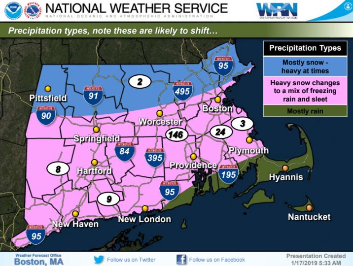
Areas north of the Massachusetts Turnpike and I-95 corridor may receive 1 to 2 feet of snow.
Southern parts of the state may see a transition from snow to rain, and an area in between may see periods of sleet and freezing rain.
That second storm will be followed by a flash freeze and frigid temperatures.
According to the National Weather Service, flooding could be an issue early Sunday in low-lying areas and roads vulnerable to flooding.
There could also be some beach erosion and heavy surf.
The Massachusetts Emergency Management Agency said there is overall high confidence for a moderate to high impact storm, but confidence in exact details and timing remains low at this time.


