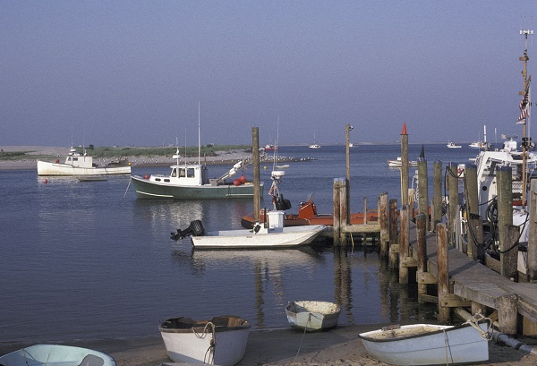
Chatham Harbor
CHATHAM – A study recently presented to Chatham officials showed worsening conditions for Chatham Harbor with difficult navigation for larger vessels.
Applied Coastal Research and Engineering and the Center for Coastal Studies offered preliminary findings of the first phase of a study of east-facing waterways.
The goal of the study by Applied Coastal Research & Engineering and Center for Coastal Studies is to understand how waters and the interactions of the two inlets are effecting flow and changes to beach and inlet morphology. The changes may cause substantial issues relative to shoreline erosion, navigation and impacts along the mainland.
The town was awarded a coastal resiliency grant earlier in the year by Massachusetts Coastal Zone Management to perform a sophisticated analysis of the eastern waters and shoreline.
The study is a result of a series of strong storms last year which produced a lot of flooding and erosion.
The analysis focuses on changes to the inlet and barrier island system since the 2007 inlet formation and morphological evolution of the shoals and channels with a focus on changes in water levels, current speeds, and tidal flow patterns.
Preliminary model findings indicate the south inlet is feeding water to Nantucket Sound and the North Cut is providing tidal flow for Pleasant Bay with shoaling cutting off access to the South.
“A sizeable shoal at the northern end of Chatham Harbor is going to likely impact navigation for both recreational vessels and, more importantly for Chatham, our main fishing fleet located at the Chatham Fish Pier,” said Ted Keon, Chatham’s Coastal Resources Director.
The lack of sand coming from the north is also causing the quick breakdown of North Beach Island.
Although the study doesn’t include clear recommendations for action, it did acknowledge that dredging would likely be necessary for viable navigation.
“Unfortunately there are no clear cut best places to do it,” Keon said. “And even if you do do it the longevity of these channels is very much uncertain.”
Keon said boaters have to work the tides to be able to get in and out of the harbor.
“It really is not passable at low tide,” he said. “Even the Coast Guard is having difficulties getting in and out.”
Keon said the conditions are a legitimate safety and navigation issue for the fleet.
“It’s expected to continue until ideally some level of dredging might be able to be accomplished,” he said.
Phase two of the study, which is underway, will focus on land change projections for the next several decades.