


NWS Boston/CWN
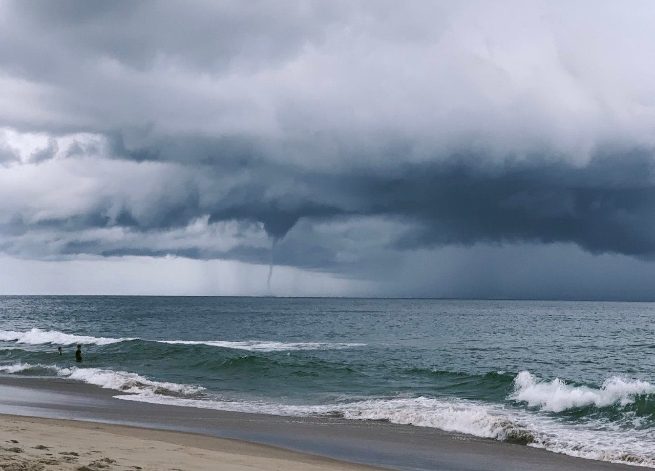
Nice looking waterspout from Duck Harbor in Wellfleet, MA this afternoon. Thank you to @WX1BOX for passing along this photo #MAwx
The photo was taken around 320PM Thursday afternoon. https://t.co/93J5l8cVtH
— NWS Boston (@NWSBoston) September 10, 2021
Flooding reports coming into the National Weather Service:
Skywarn reports Route 6 eastbound between exits 82 and 85 (old exits 10-11) there was an estimated 2-3 inches of street flooding covering the highway. Significant street flooding on Bank Street in Harwich with 4 to 5 inches of water in a couple of spots. An amateur radio operator in in Chatham reported both southbound and northbound lanes of Route 28 at Frost Fish Road with 2.5 inches of rain measured in the roadway.
Rainfall reports from NWS: Chatham, MA: 3.87″, Orleans, MA: 6.95″, Harwich, MA: 5.35″, Woods Hole, MA: 2.27″, Pocasset, MA: 2.16″, Marstons Mills, MA: 2.62″
Editor’s note: This is the original NWS statement on the waterspout in Wellfleet Harbor:
Special Weather Statement
National Weather Service Boston/Norton MA
313 PM EDT Thu Sep 9 2021
…A thunderstorm capable of producing a waterspout will impact portions of northeastern Barnstable County through 400 PM EDT…
At 312 PM EDT, Doppler radar was tracking a thunderstorm capable of producing a waterspout over Cape Cod Bay, near Wellfleet, or 10 miles southeast of Provincetown, moving northeast at 30 mph.
HAZARD…Waterspouts, winds in excess of 40 mph, and pea size hail.
SOURCE…Radar indicated.
IMPACT…Waterspouts can easily overturn boats and create locally hazardous waters. Gusty winds could knock down tree limbs and blow around unsecured objects. Minor damage to outdoor objects is possible.
Locations impacted include…
Wellfleet and Truro.
PRECAUTIONARY/PREPAREDNESS ACTIONS…
If outdoors, consider seeking shelter inside a building.
This storm may intensify, so be certain to monitor local radio stations and available television stations for additional information and possible warnings from the National Weather Service.


